Distance: 1.6 miles from trailhead to Long Point; 3.2 miles out-and-back
Difficulty Rating from NPS: Moderate
 A classic out-and-back jog just over 5k in distance, Long Point Trail provides a well-rounded degree of technicality and difficulty suitable for a beginner's introduction to what trail running has to offer. It is also a great tack-on addition to other trails for longer runs. As it intersects with Fayetteville Trail and Butcher Branch Trail, you can access nearly any other trail in the Canyon Rim area from here, and the point rewards any trek with a picturesque view of the famous New River Gorge bridge.
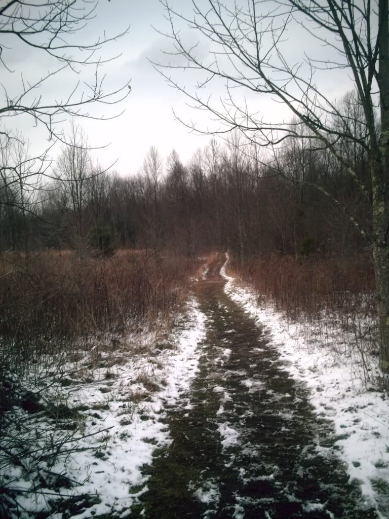
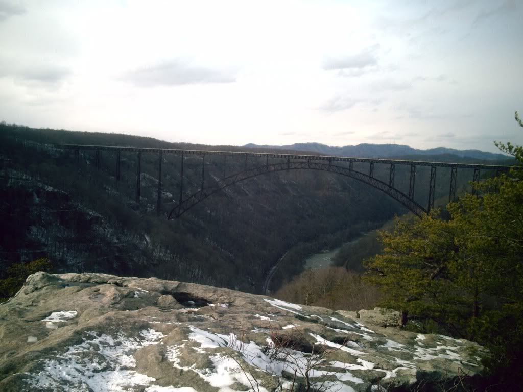
Last Saturday morning started out at a sunny 29, and, although a bit chilly, by about 3:00 I figured that I may as well not waste the sunshine and should get a short 3-miler in. Long Point, a location commonly known for its photogenic views of the Gorge and the bridge, is 1.6 miles from the trailhead, and the trail is relatively flat, compared to other trails in the area (it'll surprise you, though). A decent amount of the trail is wide and even, with a few hills and enough uneven, technical terrain that I often bring my non-trail runner friends here when they ask me to take them trail running to see what it's all about.
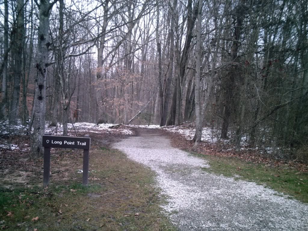
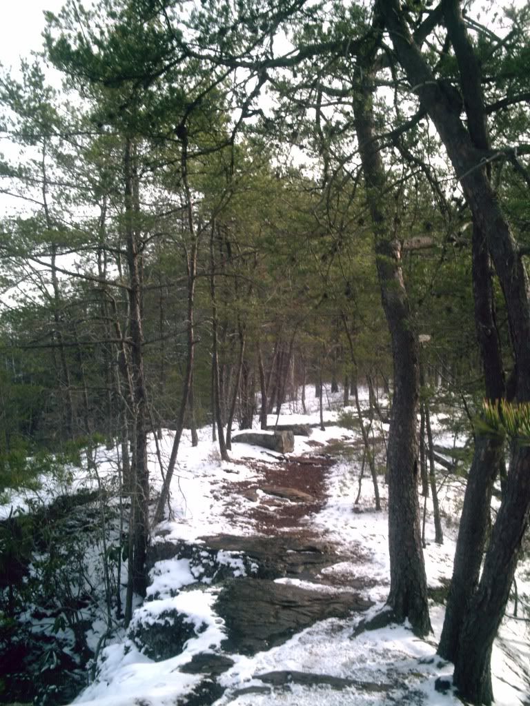
The trail begins on a wide pathway straight into the woods. The gravel from the parking lot only lives a short life on the trail, fortunately soon giving way to packed dirt. About as soon as that happens, the trees disappear for a little bit as you hit a field with a wooden walkway over a soggy part of the path. Then it's back to the packed dirt, and the trail continues this way, rolling and dipping back into the woods .
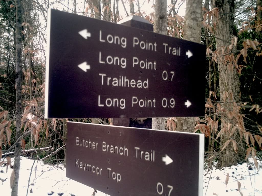
Less than half a mile into the trail, you'll pass the intersection where Fayetteville Trail crosses your path. Taking a right will dump you out at the Kaymoor Top Trailhead after 2 miles, which is the access point to Kaymoor Miner's Trail, Craig Branch Trail (which might have been renamed again--I'm still not ever too sure what that trail's name is), the new trails that the Boy Scouts are putting in (Arrowhead Trails), and Butcher Branch Trail--another connection between Long Point Trail and Kaymoor Top. Turning left onto Fayetteville trail can take you all the way to the community park in Fayetteville, and, past that, to the middle of Fayette Station Road across from the Ace Gear Shop.
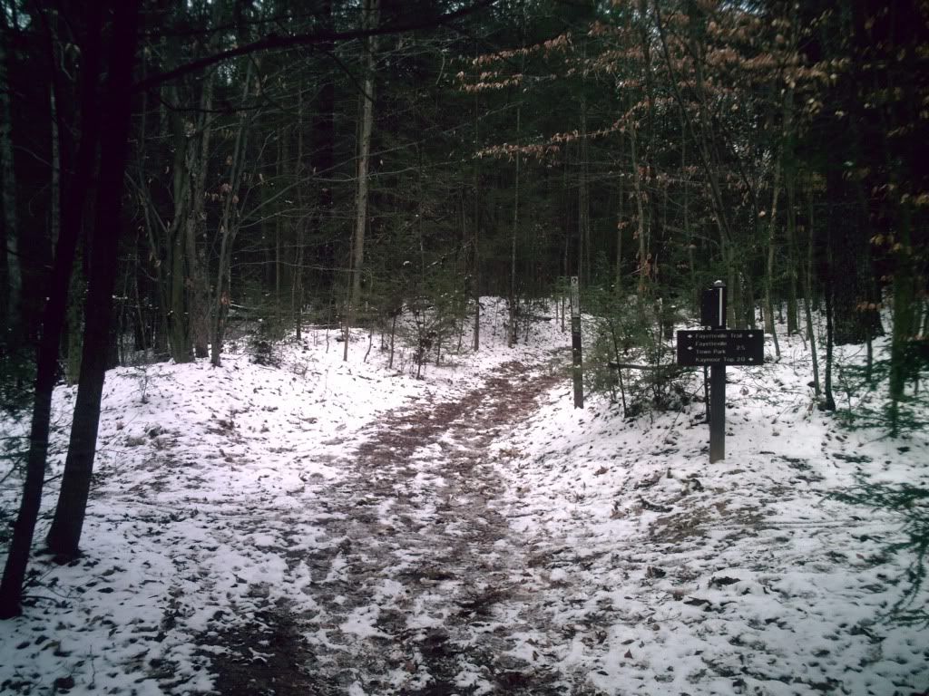
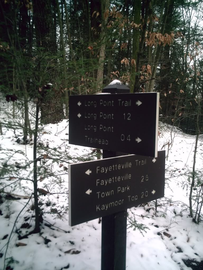
Another three tenths of a mile down Long Point Trail will bring you to one end of Butcher Branch Trail, a fun little connector that is a little less than a mile from Kaymoor Top. This trail also has access to climbing routes.
 As you may have ascertained from the picture on the left, the point is almost right about a mile from here. So far, the trail has generally been pretty wide--I'd say about the size that an ATV could fit (I don’t endorse motorized vehicles here--it’s against rules and ruins the trail). The trail will continue in this fashion until you're approaching Long Point. There will be a steep downhill with a lot of rocks, and the trail will narrow considerably--this is when you know you're near the end (or middle, depending how you look at things).
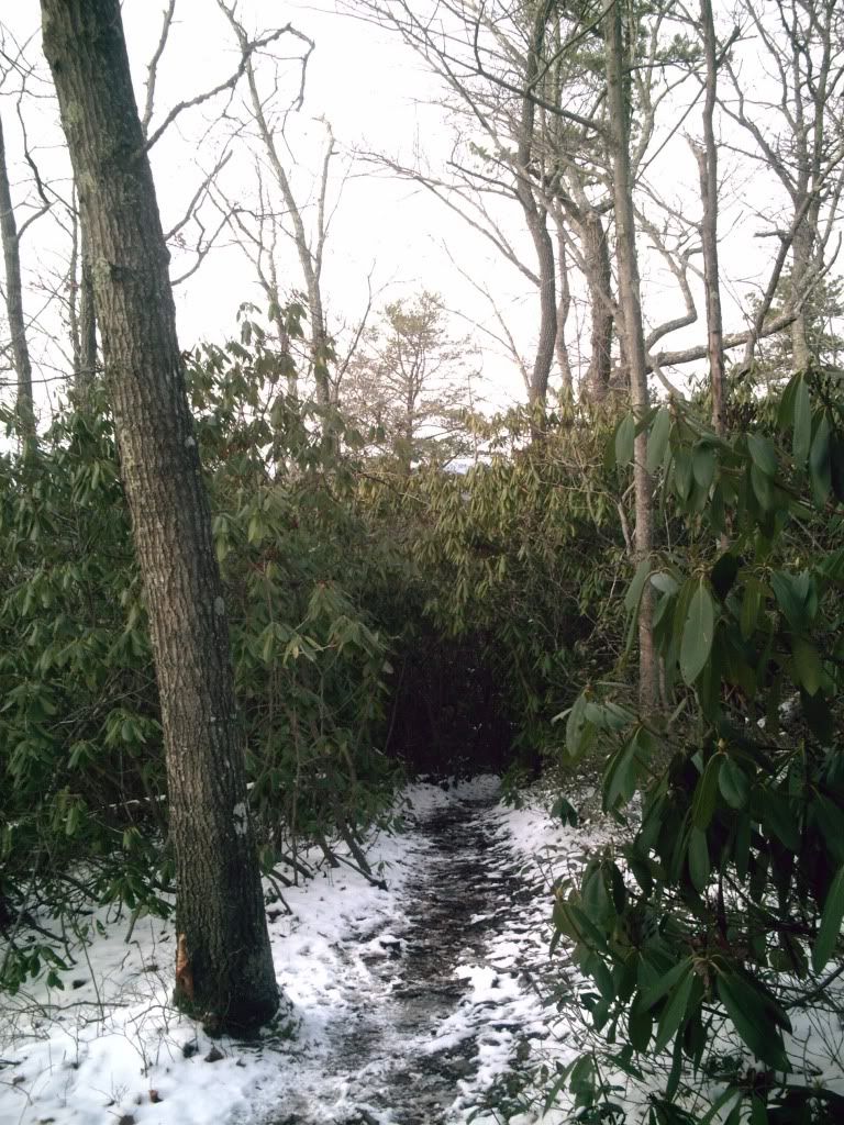 Soon, you will find yourself entering a thick rhododendron tunnel/trench sort of section of the trail, which is pretty cool, but watch yourself: the trail becomes noticeably more technical in here, and you'll have to soon pay attention that you don't slip off-trail and tumble down towards certain critical injury or death. :) Just kidding. Sort of.
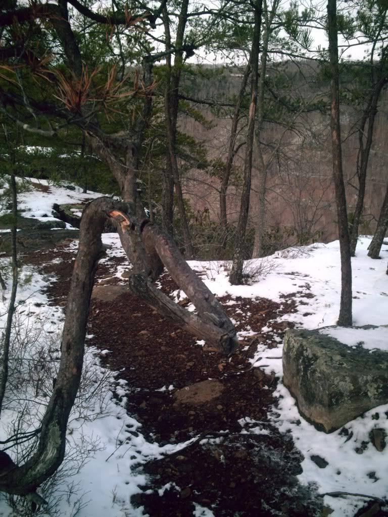
Before you know it, you'll exit the rhododendrons, and the outcropping will nearly be in sight, as well as the bridge. In your haste for a full view of the beauty that so strongly calls us out to these trails, don't forget to look out for a particular crazily-twisted old lance of a tree that has caused me numerous pains in my shoulder and chest area on my more absent-minded runs.
 |
| If you're not careful, you could get this battering ram straight in the shoulder. |
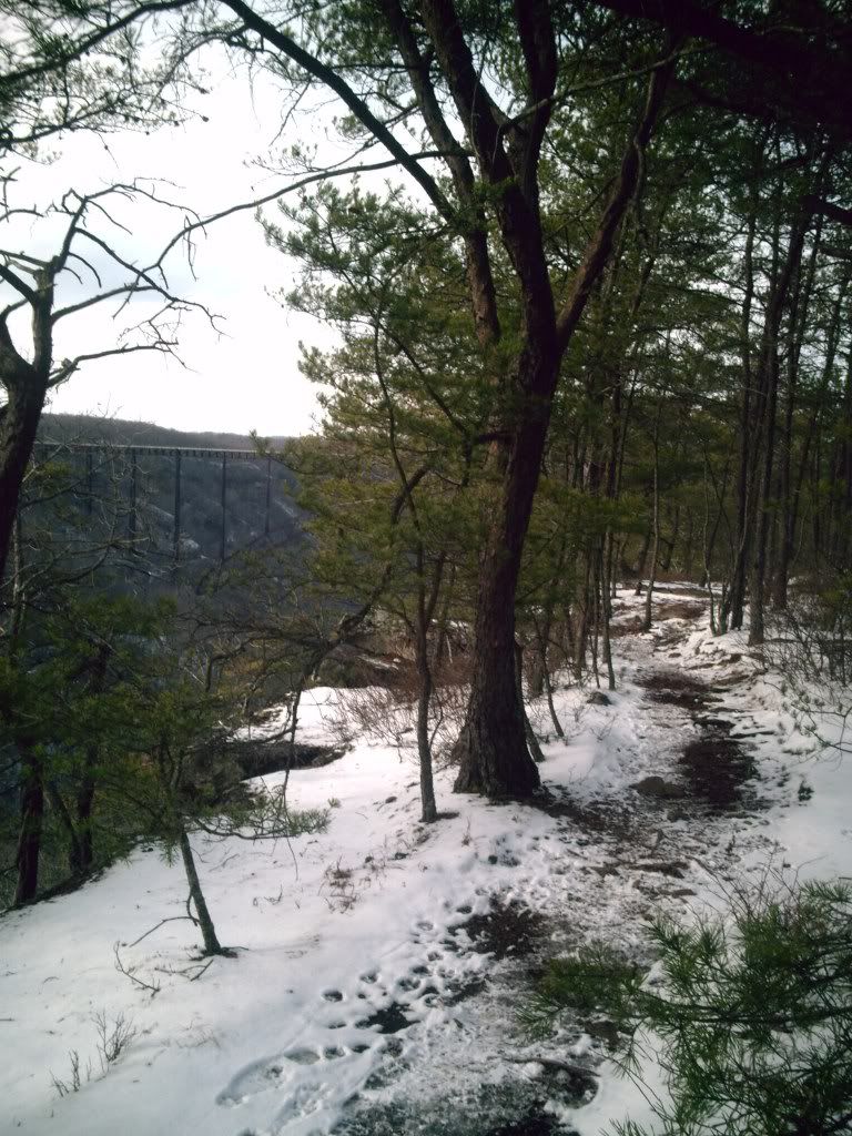 |
| Almost there! |
Don't waste your run by immediately turning around without at least stopping long enough to catch your breath and enjoy what is probably the best view of the New River Gorge Bridge.
 The run back is usually what gets people about this trail. It even amazes me how easily some of those hills that seemed pretty harmless running down can kill your motivation on the way back. The worst of it comes soon after turning around, leaving little time to gain any momentum significant enough to take you up the trail quickly. Most people I take running here who are new to trail running have the hardest time on the hill coming back right after the point, and they are so used to just casually hiking the trail that the difficulty surprises them. Still, it's certainly not the worst incline anyone will ever deal with running in the NRG--or even many roads in WV.
If you want just a few extra miles to stick onto this run, I advise taking Fayetteville Trail to Kaymoor Top and then cutting back onto Butcher Branch Trail once you get there. It's a fun, somewhat technical (in some places) addition to make your run last a little longer. Ok, I'm going to break down and be honest here--for the longest time (up until actually writing this and looking at the signpost pics), I thought that the FT-BBT loop was only an approximate mile. I guess it's more like 3. That probably explains why that "extra mile" I convinced my girlfriend to run with me one evening ended up a lot darker than I had planned...
For even longer runs, I'll run to Kaymoor Top and then take the loop down Kaymoor Miners and up Craig Branch Trail, then come back to the LP Trail via Butcher's Branch. Long Point Trail is great on its own for a short, pretty run, but it also leaves room for creative amendments to adjust your mileage.
No comments:
Post a Comment